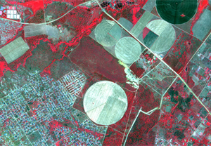
Operational remote sensing data and services in India were initiated with the launch and commissioning of IRS-1A, the first operational Indian Remote Sensing (IRS) Satellite, in the year 1988. By then, India established an institutional mechanism in the country, namely National Natural Resources Management System (NNRMS) to drive the country to operationally utilize the data from these satellites. Since then, many IRS satellites were realised by India. Currently Indian Space Research Organisation (ISRO) operates four series of satellites namely, Resourcesat, RISAT, Cartosat, Oceansat. Meteorological services are provided through INSAT-3D/3DR satellites.
Antrix, the commercial arm of ISRO, makes the products and services emanating out of these satellites to International Users. Antrix has been providing IRS Satellite data to International users directly, or through resellers. Antrix also enables users to directly downlink the data at the user ground station. With 30 years of Applications in Remote Sensing, ISRO has developed a expertise to provide consultancy services to users in diversified field and Antrix could effectively provide these expertise consultancy to users.
Remote Sensing Data and Services
Indian Remote Sensing (IRS) Satellite Data and Services for International Customers
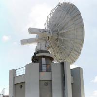
Antrix enables users to directly download IRS Satellite Data at their ground station by providing necessary Hardware and Software. Following Satellite Data could be directly accessed:
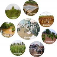
ISRO’s operational remote sensing programme started with the launch of IRS-1A in the year 1988. Since then, many applications projects have been carried out in wide varieties of themes starting from Agriculture, Forestry to Disaster Management Support. Through Technical Consultancy from ISRO, Antrix carries out Consultancy Remote Sensing & GIS.
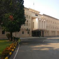
IIRS, a 50 years old institute of ISRO, is a key player for training and capacity building in geospatial technology and its applications in Southeast Asia. ANTRIX brings in customised training to users through this globally renowned institute.
ISRO’s Indian Institute of Remote Sensing (IIRS) is a 50 year old institution and a key player for training.
 080-2217 8352
 prince[at]antrix[dot]co[dot]in